No products
Prices are tax included
Moon Map
Carte de la Lune
New product
A new format for exploring the moon with the naked eye, binoculars or telescope
45 Items
Available.
More info
Moon Map
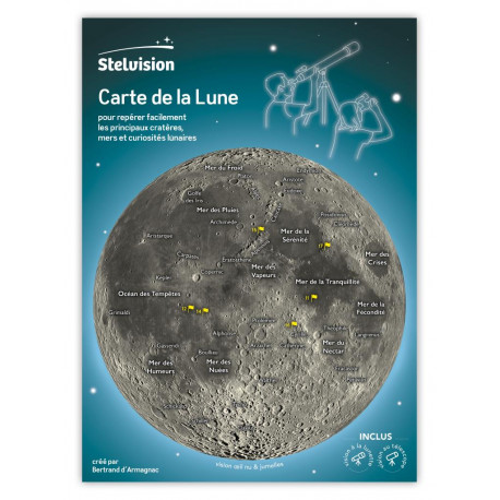
In the form of a practical and robust leaflet, the Moon Map shows the seas, the main craters and reliefs, and the six landing sites of the Apollo missions.
The map is declined in three versions to answer all the situations of observation. On the cover, a first map corresponds to the vision with the naked eye and the binoculars. Inside the leaflet, a reversible plug shows the appearance of the Moon when it is observed with an astronomical instrument: right-left inverted vision in the case of an astronomical telescope and reversed vision right-left / high- down for a telescope. Nine of the most spectacular lunar landscapes are detailed. Finally, explanations of the phases of the Moon are given to help the observer plan his observations.
This product appears on the occasion of the fiftieth anniversary of the Apollo 11 mission celebrated in 2019. But beyond this anniversary, the Map of the Moon is intended to be a permanent part of the panoply of any observer of the sky!
Product designed and made in France (in Toulouse and Tarn).
30.3 x 22 x 0.2 cm, 4-page folder and removable plug, plastic sleeve | ISBN: 978-2-9563417-3-4 | Stelvision editions | May 2019


